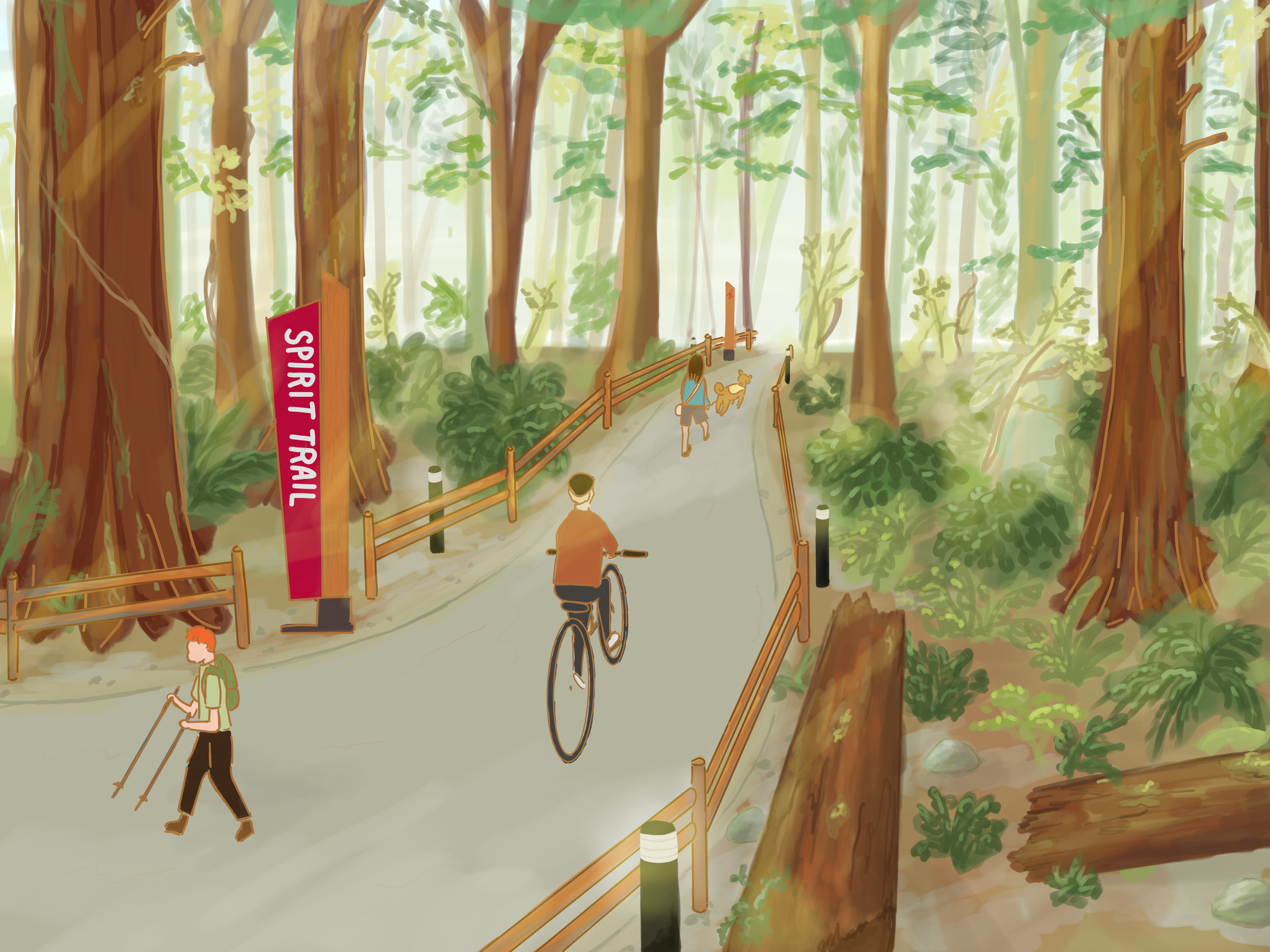
Spirit Trail Eastern Extension
Planning and design work is well underway on the Spirit Trail's eastern extension, which will provide a continuous active transportation connection linking key destinations and neighbourhoods east of the Seymour River once completed.
This planning work began after Council approved a five-year Capital Plan in April 2023 that includes $20 million to continue building the Spirit Trail.
Thank you to the more than 600 participants who attended the Spirit Trail info sessions on February 21 and March 6. If you missed the meeting, don't worry--there's still time to get involved. The route has not been set, so please view the information boards and email us at eng@dnv.org if you have any questions or thoughts to share with the project team.
Route
While the route has not been set, work will focus on a route south of Mount Seymour Parkway as it presents the best opportunity to connect more neighbourhoods and destinations.
It is important to know that the specific routing for most segments is not yet known. In other locations, a proposed route is shown as there are limited options.
Considerations about the various route options will include, but are not limited to, safety, comfort, cost, technical feasibility, land use constraints, topography, environmental impacts, First Nation interests and more. No matter which route best balances all of those considerations, professional detailed engineering work will address many of the concerns we’ve heard regarding Spirit Trail users sharing space with existing users of the street or trail.
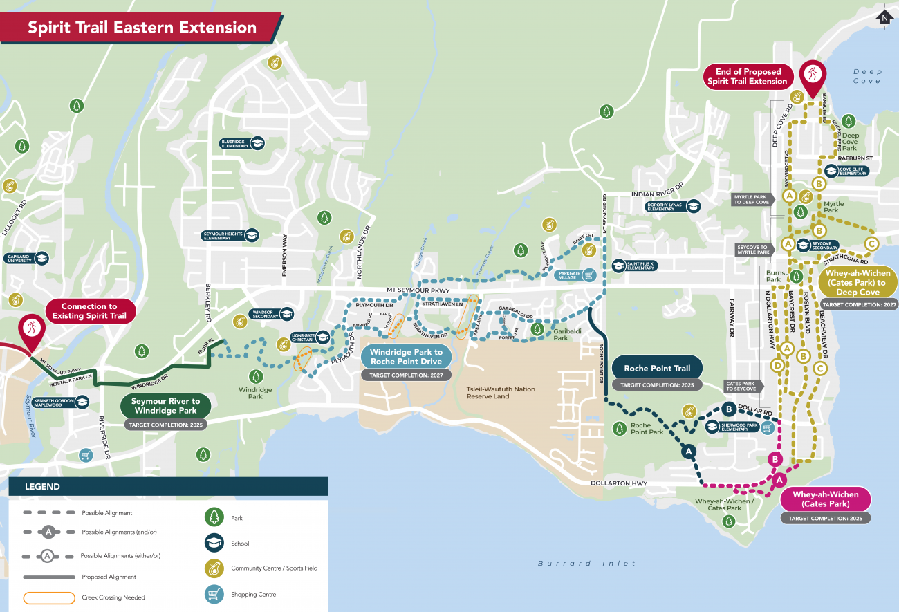
What will the Spirit Trail Eastern Extension look like?
The designs of each segment will reflect the local conditions, setting, and topography. These illustrations give examples of the many possible route configurations:
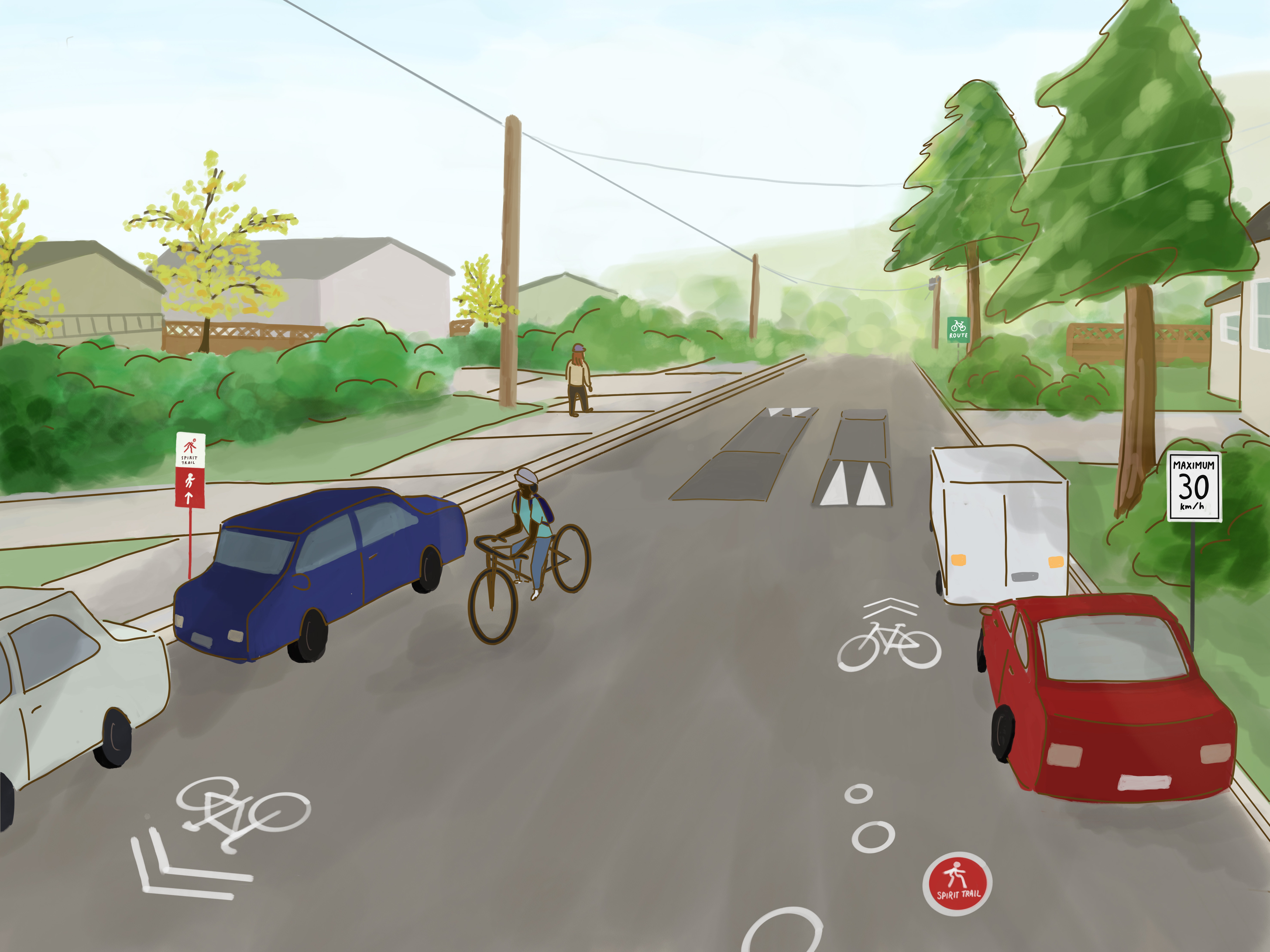
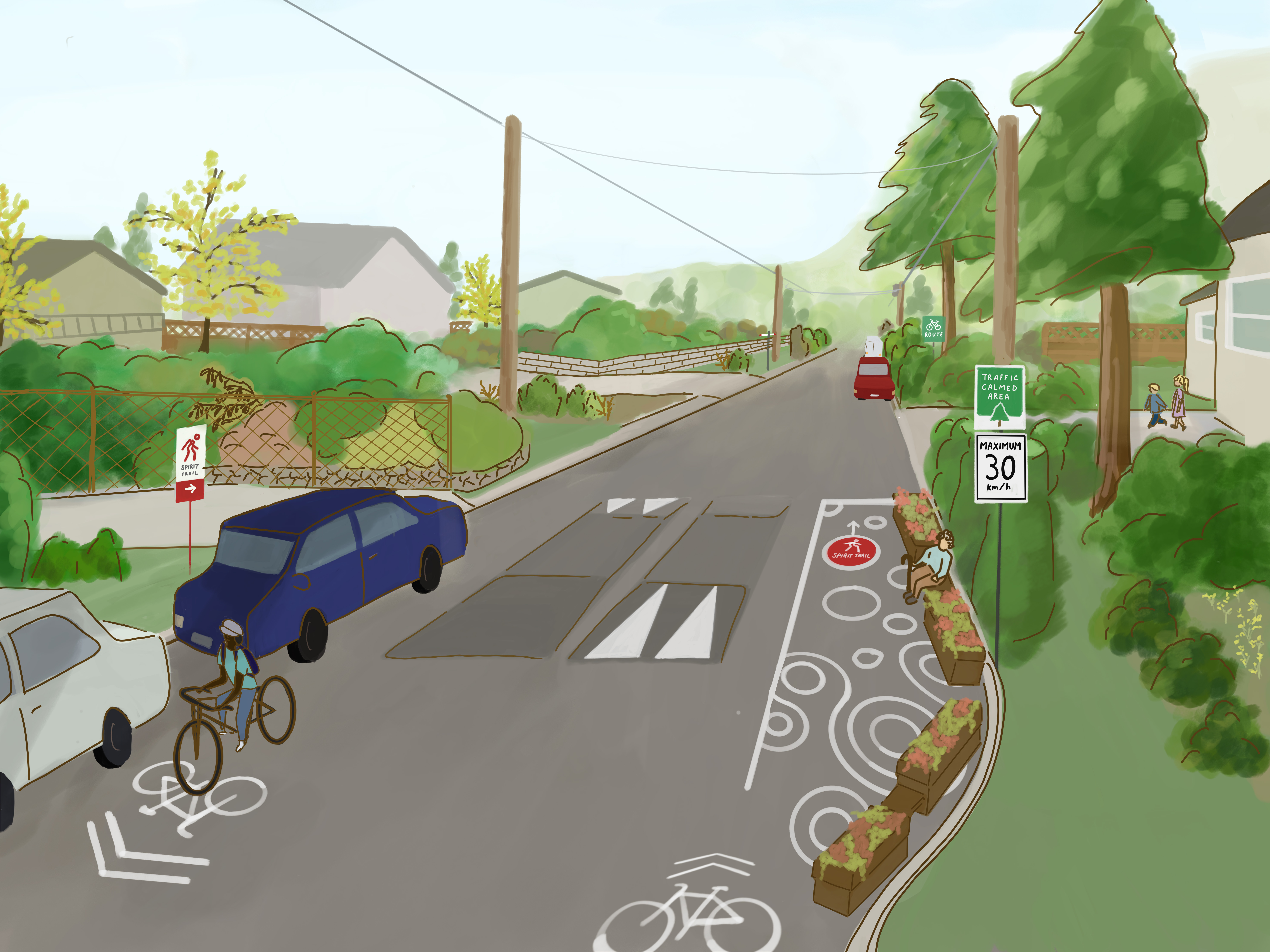
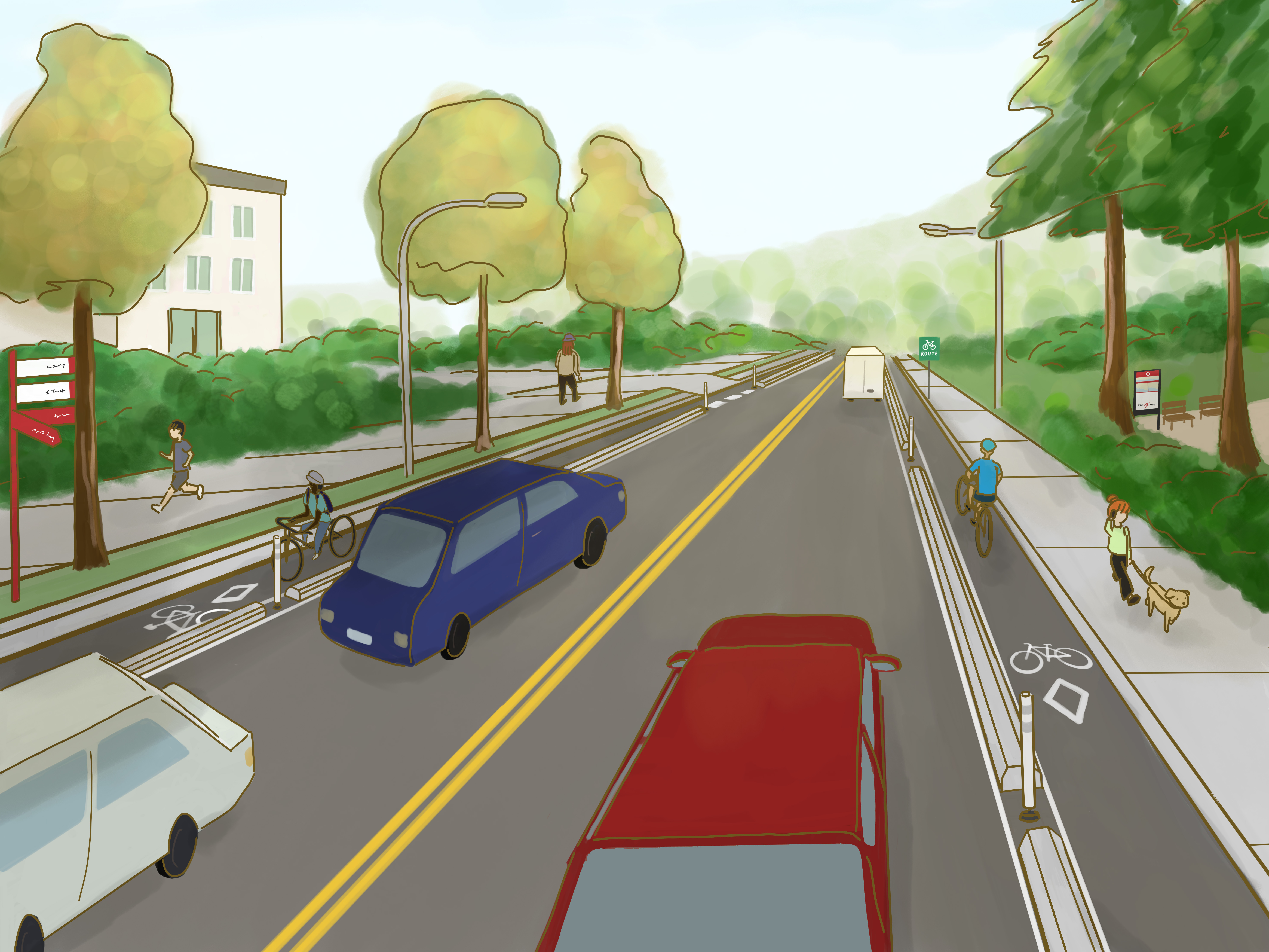
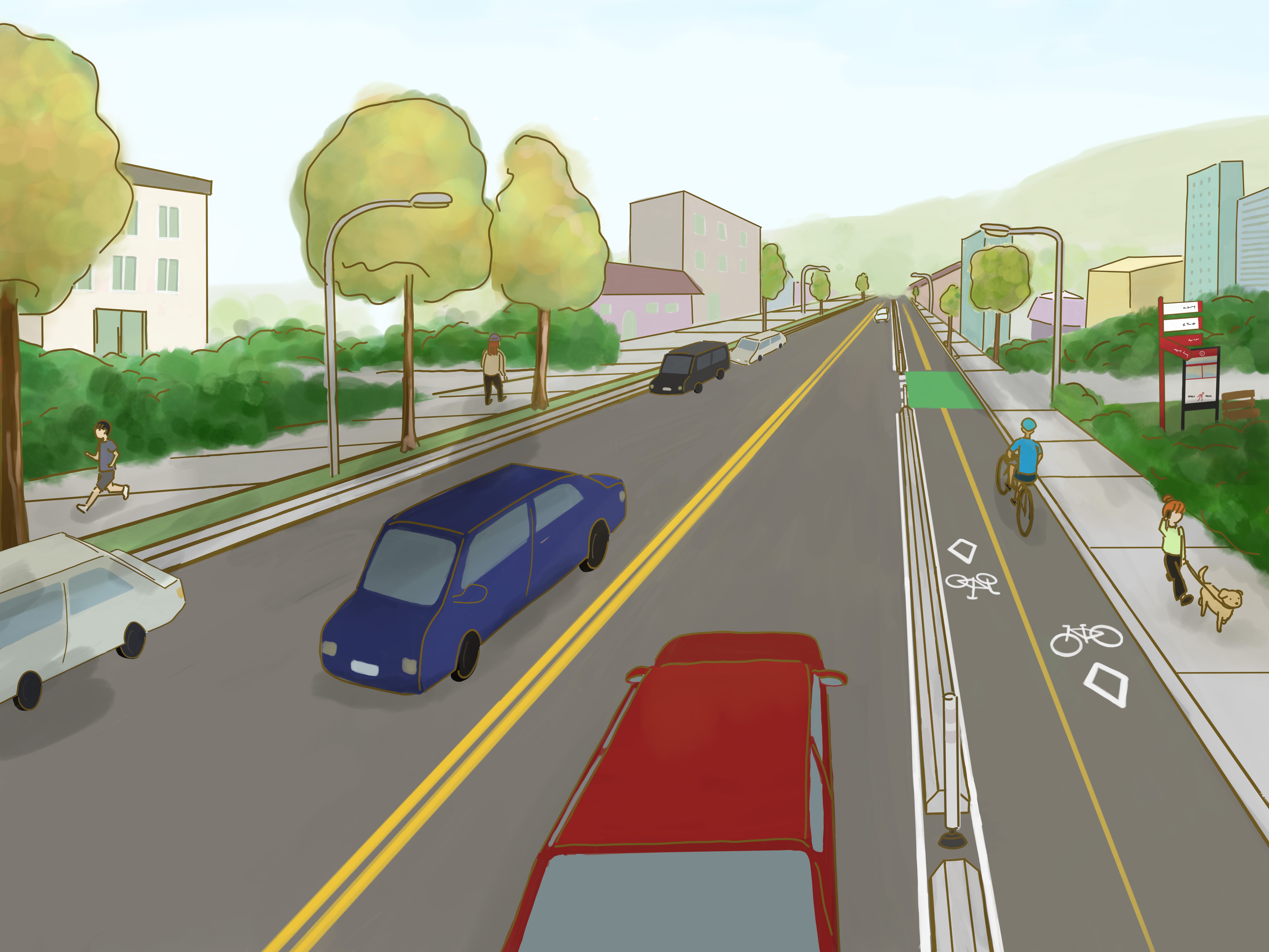
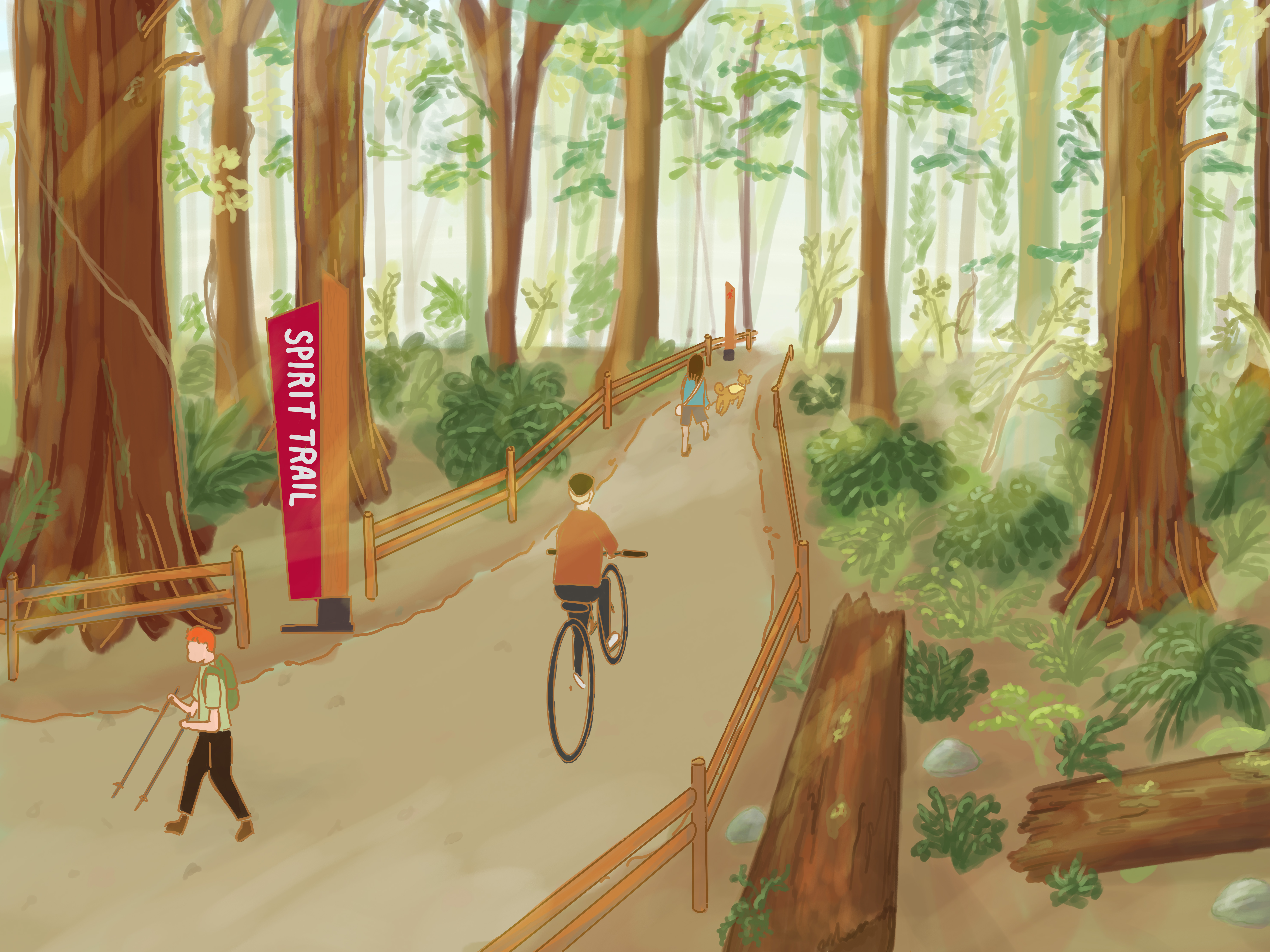
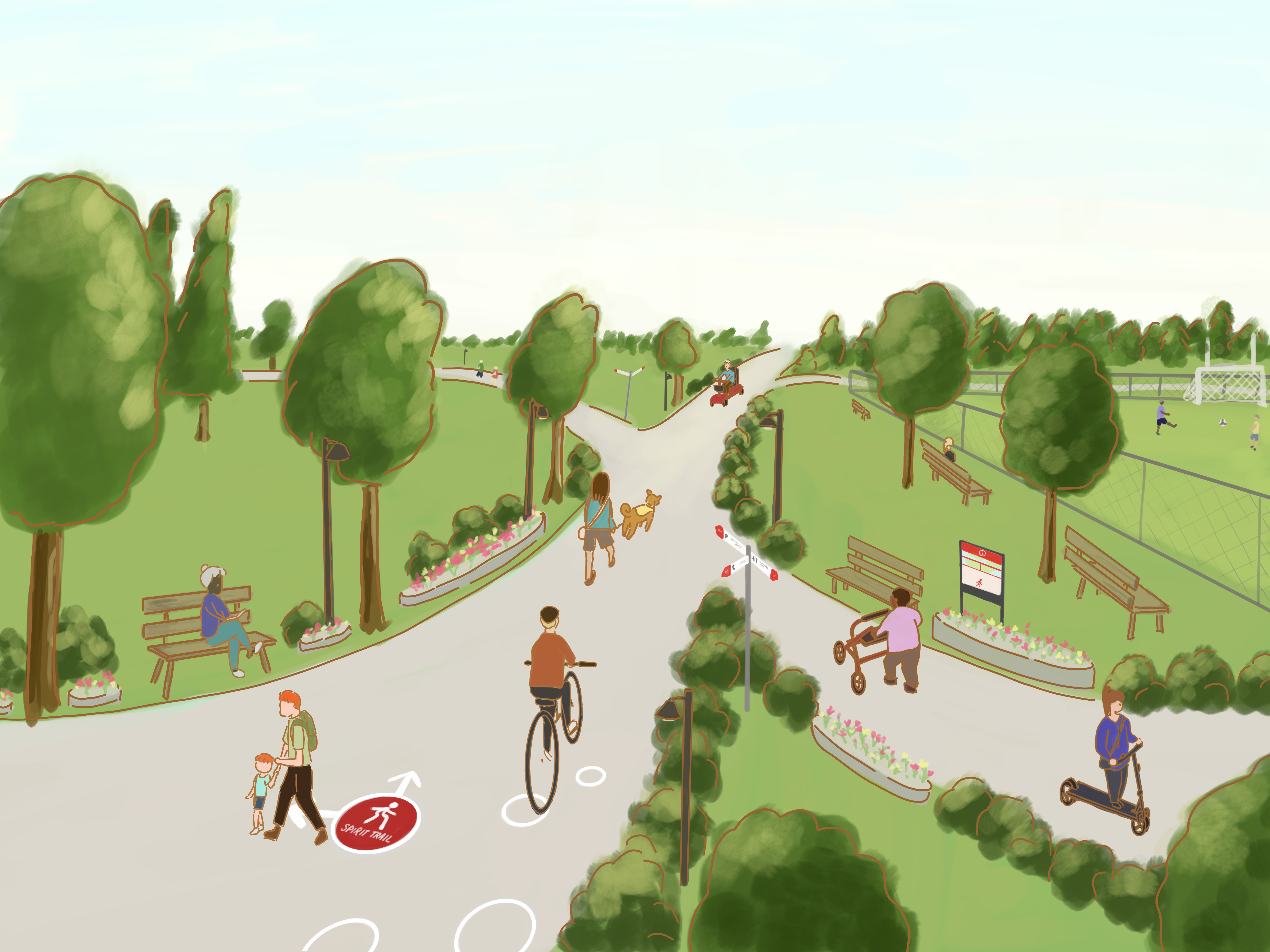
As designs develop, there will be opportunities for input from local neighbourhoods and broader community about what the Spirit Trial will look like along its length.
Timing
The Spirit Trail Eastern Extension will be a multi-year effort that connects a series of separate projects delivered on individual timelines. Some segments will be constructed soon, while some segments will take longer as they are either technically challenging or require further discussion with neighbourhoods.
Seymour River to Windridge Park
The first project to progress is a segment connecting the existing Spirit Trail west of the Seymour River with Windridge Park. Planning and design work for this segment is well underway.
The trail segment will consist of a variety of facility types, such as multi-use paths, neighbourhood bikeways, and protected bike lanes.
A new pathway connection will be completed within the greenbelt north of Kenneth Gordon Maplewood School, connecting to Riverside Drive.
On Heritage Park Lane and Windridge Drive, the priority will be improving cycling safety using signage, pavement markings, low-cost adjustable materials, lighting, and intersection improvements.
Key destinations along this segment include the Maplewood community, Seymour River Heritage Park, Kenneth Gordon Maplewood School, Canlan Sports recreation facility, Browning Place, Berkley Care Centre, and Windridge Park.
Getting started
We expect to start construction on the Seymour River to Windridge Park trail segment in late 2024 or early 2025.
Topographic surveys, as well as tree, environmental, and archaeological assessments, are all underway for this section. Similar work is also underway for a Cates Park/Whey-ah-Wichen segment and a segment connecting Dollarton Highway to the Parkgate area through Roche Point Trail.
Mount Seymour Parkway
In support of the Spirit Trail, improvements to cycling infrastructure on Mount Seymour Parkway are planned to begin in 2024, to provide more separation between vehicles and bicycles.
The existing painted bike lanes on Mount Seymour Parkway between Seymour Boulevard and Mount Seymour Road are well used but not comfortable due to high vehicle traffic speeds and a lack of physical separation between vehicle lanes and bike lanes.
Improved safety and comfort for cyclists along Mount Seymour Parkway will provide better connectivity to and from individual Spirit Trail Eastern Extension segments as they are completed over time.
Working with səlilwətaɬ (Tsleil-Waututh Nation)
The səlilwətaɬ (Tsleil-Waututh Nation) and District are collaborating to determine the location of the Spirit Trail's eastern extension, with the goal of serving the entire North Shore community.
In recognition that the land surrounding Dollarton Highway holds deep cultural significance as səlilwətaɬ reserve land and traditional territory, and is home to a thriving community, the options for the Spirit Trail Eastern Extension intentionally avoid Dollarton Highway through reserve land.
"As stewards of this land for generations, the significance of preserving our cultural heritage cannot be overstated. The decision to avoid Dollarton Highway aligns with our commitment to respecting our ancestral lands and ensuring their preservation for future generations," says Chief Jen Thomas, səlilwətaɬ (Tsleil-Waututh Nation).
The historical context of Dollarton Highway, constructed in the 1930s without compensation to the Tsleil-Waututh Nation, underscores the importance of thoughtful collaboration and community-focused initiatives.
Moving forward, the səlilwətaɬ and the District remain dedicated to exploring innovative solutions to enhance safety and accessibility along Dollarton Highway for all residents, cyclists, pedestrians, and motorists.
In a proactive step towards this goal, səlilwətaɬ and the District are pleased to announce their collaboration on a sidewalk project along Dollarton Highway. This initiative represents a significant stride in improving infrastructure and fostering a safer environment for all road users.
Explore the history, vision, and values of səlilwətaɬ (Tsleil-Waututh Nation)