East 29th Street safety and mobility improvements
We are working with the City of North Vancouver to improve safety and increase mobility for all users on East 29th Street between Lonsdale and Lynn Valley Road.
This project is being delivered in two phases.
Phase 1
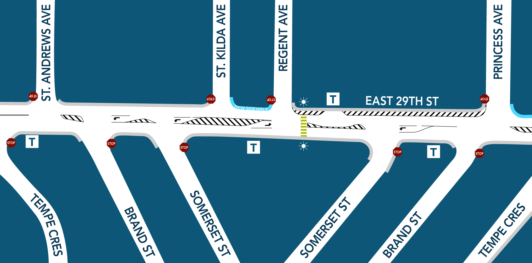
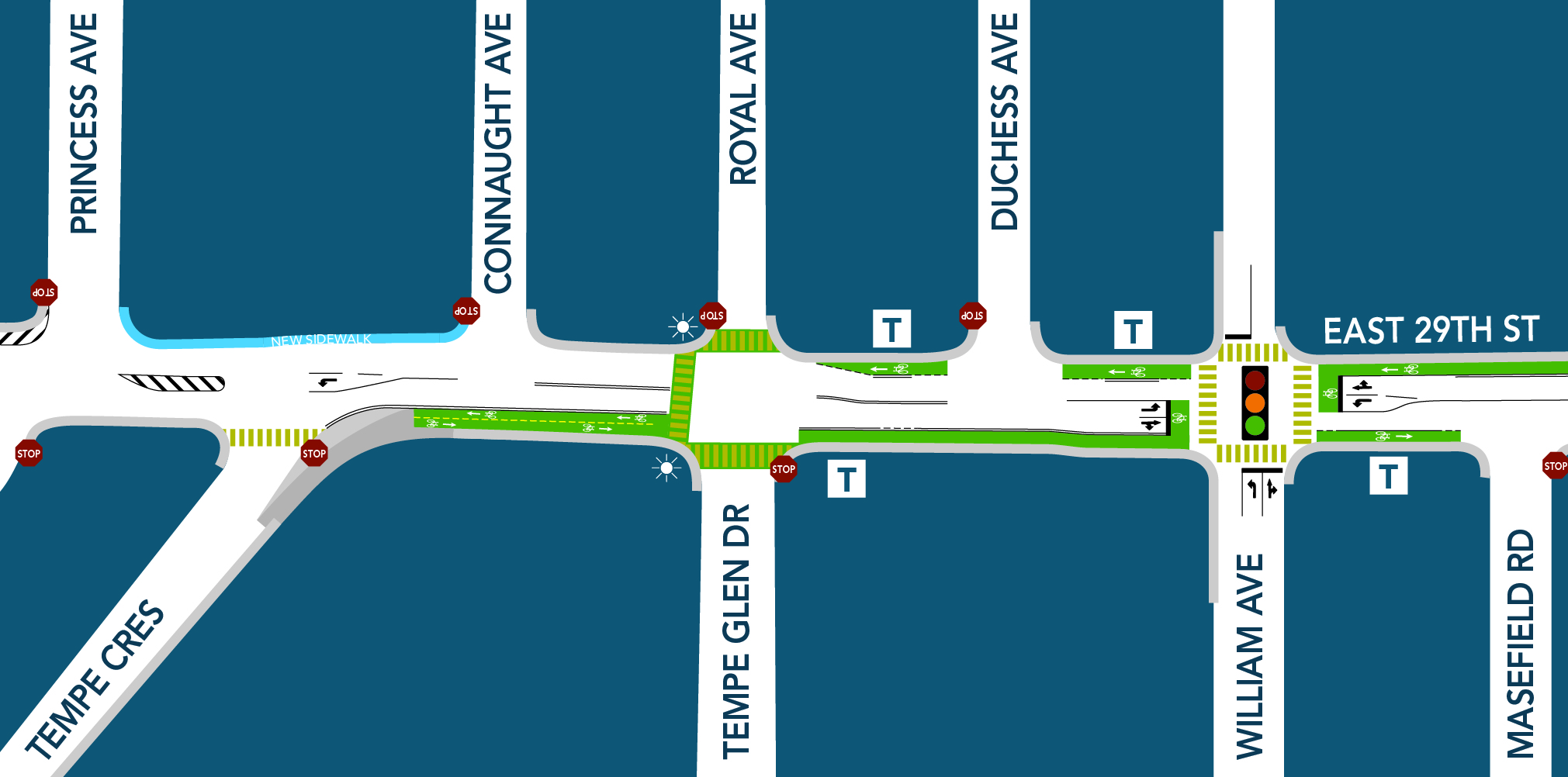
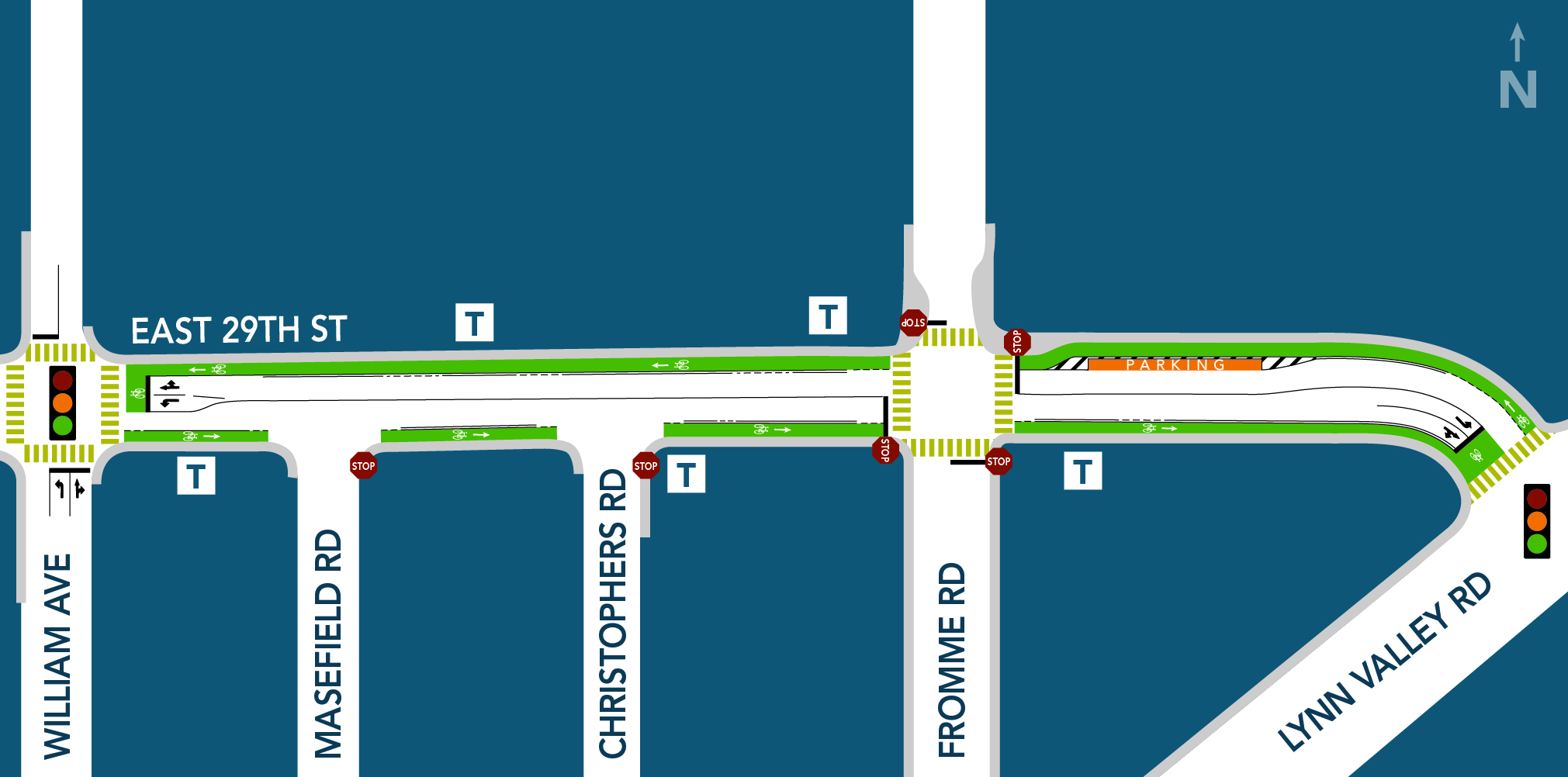
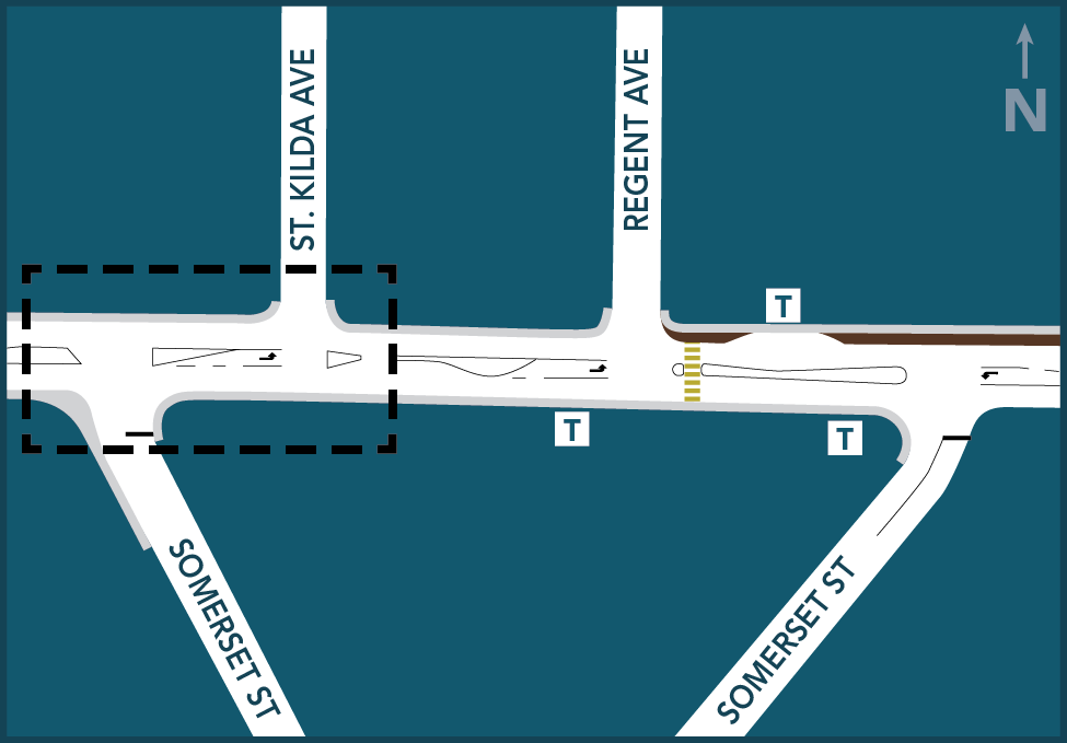
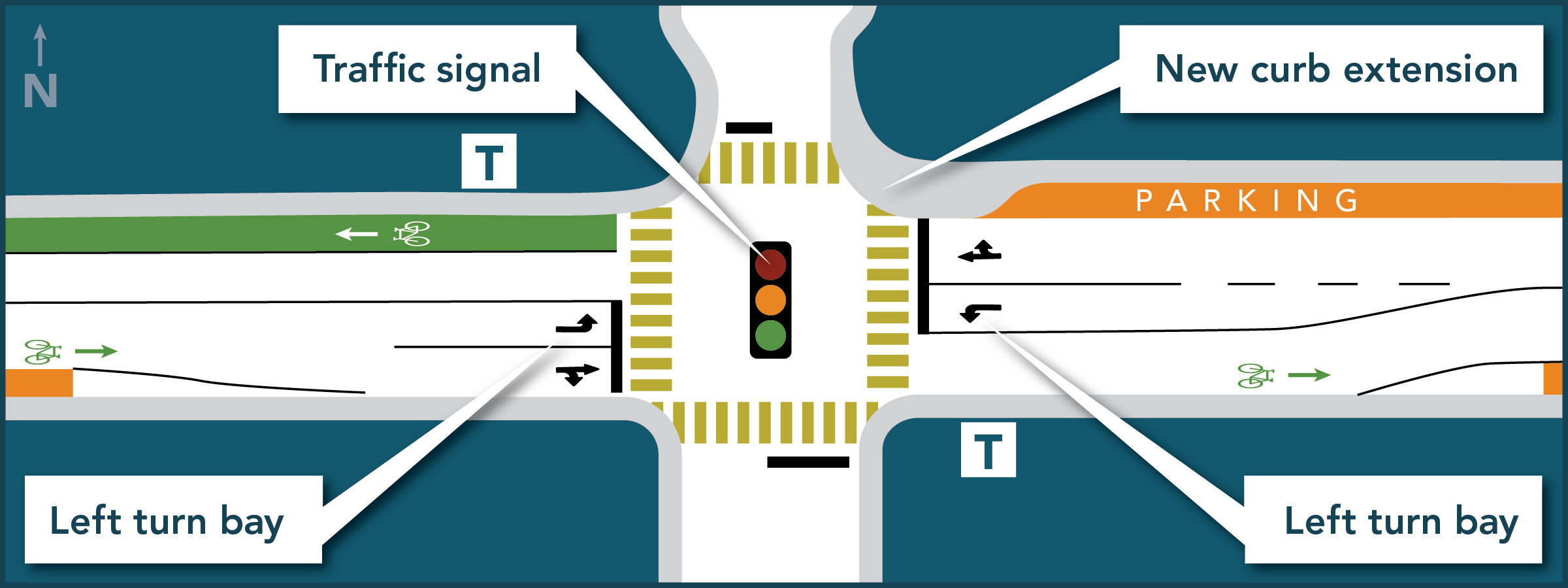
Led by the District, Phase 1 was completed in 2019 and focused on the area from Regent Avenue to Lynn Valley Road. Improvements included new sidewalks, traffic lights, left turn lanes and a protected bike lane.
Phase 2
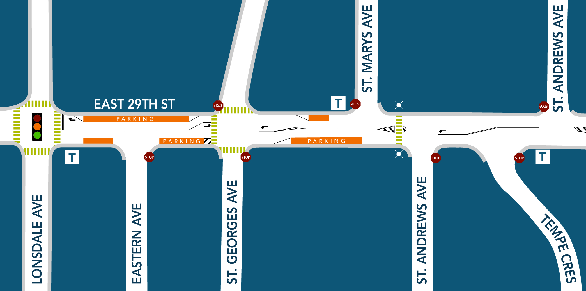
Phase 2 will be delivered by the City of North Vancouver starting in summer 2023, and will focus on the area from Lonsdale to Regent Avenue. A proposed design was created for this section in 2019, with work planned for 2020, but was postponed due to the impacts of COVID-19.
This second phase of work will move forward in 2023 and will be broken down into two components: pedestrian crossing upgrades happening this summer, and in the fall, the City of North Vancouver will be leading a process to collect community input about the plans for roadway improvements, the majority of which are currently planned for summer 2024.
Share your thoughts about travelling along East 29th Street between Lonsdale and Regent Avenue to help us make decisions about roadway improvements planned for next summer to be delivered by the City of North Vancouver. Deadline for input is Friday, Dec. 15 at 4 p.m. Learn more and share your input.
Phase 2 - 2023
November 9, 2023 — Pedestrian crossings update
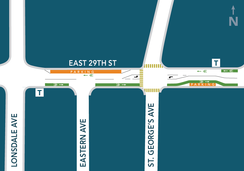
Construction of the pedestrian crossings at St. Marys Avenue and St. Georges Avenue is underway. Electrical work is complete and catch basins are installed. Concrete work is underway and expected to be complete by Nov. 24. Please note, this work is highly weather dependent and may be postponed. Pole placement is scheduled for the end of November. Please note, this work is being delivered by the City of North Vancouver.
Pedestrian crossing upgrades — Summer 2023
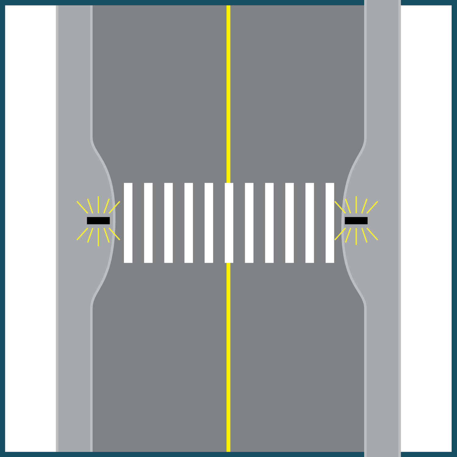
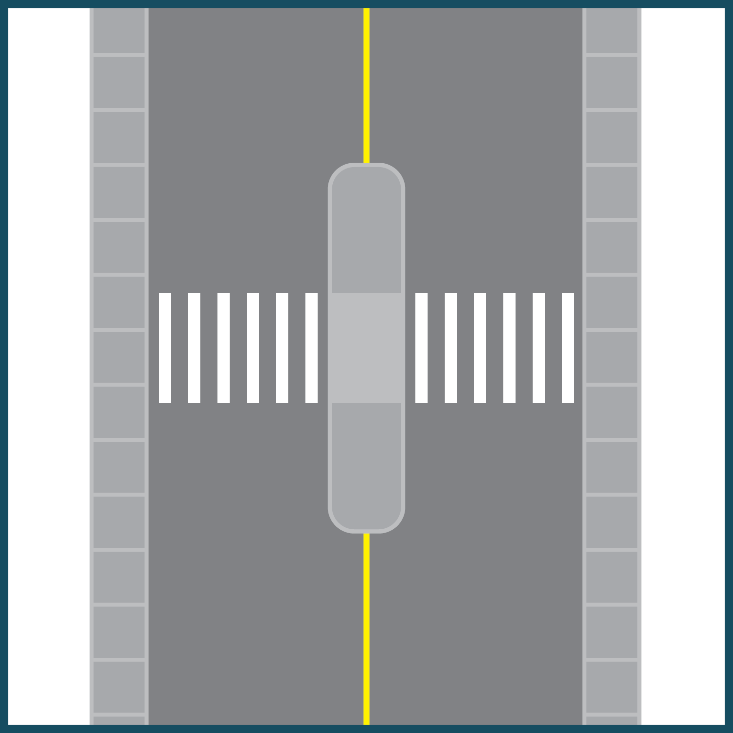
The City of North Vancouver will be installing two pedestrian-activated crossings at the intersections of East 29th and St Georges and East 29th and St Marys.
One of the concerns both municipalities have consistently heard from the community is that it is challenging for pedestrians to cross East 29th Street due to vehicle speeds and the lack of safe crossing infrastructure. In keeping with our shared priorities to provide safe and efficient transportation options and to avoid further delays in delivering these key pedestrian improvements, these new crossings will be installed in summer 2023.
Construction will begin in August and will take approximately 2-3 months to complete. The City of North Vancouver anticipates minimal impact to the surrounding neighbourhood and those who travel along this route. Advanced notice will be provided to area residents prior to any work beginning.
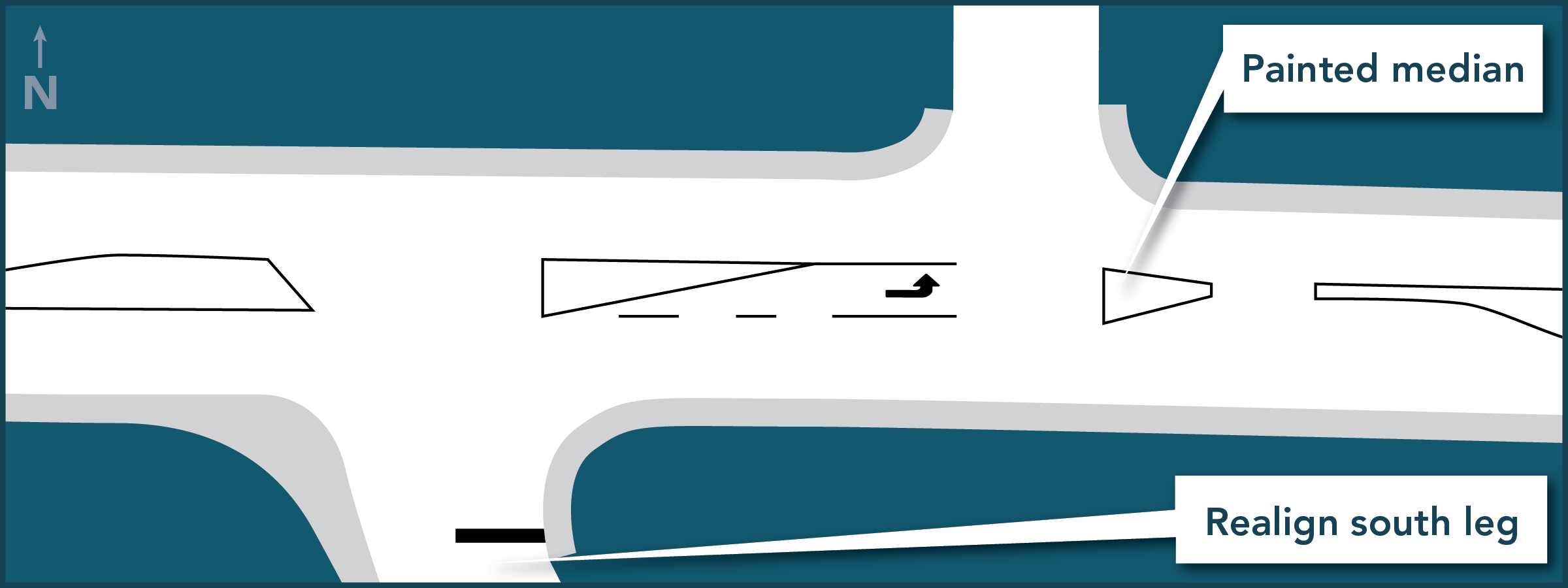
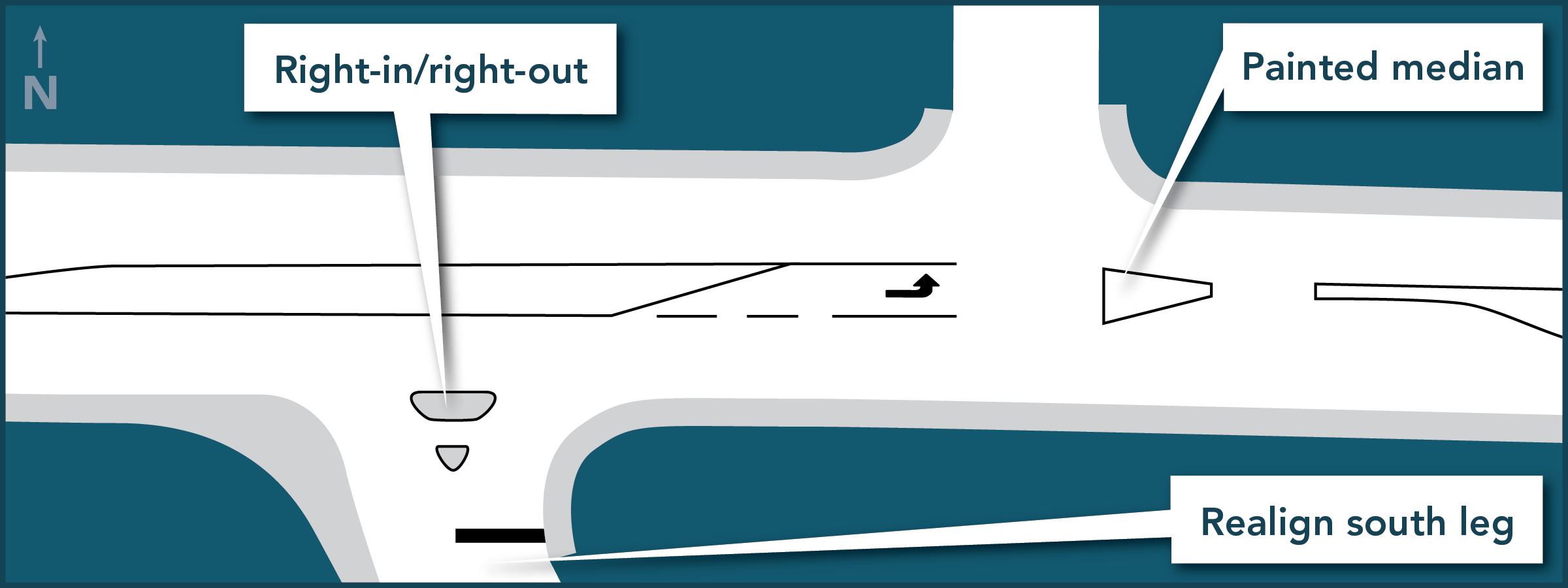
Roadway Improvements — Fall 2023 - Summer 2024
This next phase of improvements will include paving, roadway markings, intersection sightline and safety improvements and adjustments to transit stop locations to improve accessibility.
As a significant amount of time has passed, in fall 2023 the City of North Vancouver will be leading a process to reconnect with the community, review the original objectives for the project, discuss challenges and opportunities for this area, and receive feedback.
Input from residents will help to ensure the roadway improvements are aligned with the needs of the community, and will be considered along with City policy, best practices, technical and budget constraints.
Construction for these improvements is tentatively scheduled for summer 2024.
Phase 1 - 2019
Phase 1 - 2019
Led by the District, Phase 1 was completed in 2019 and focused on the area from Regent Avenue to Lynn Valley Road. Improvements included new sidewalks, traffic lights, left turn lanes and a protected bike lane.
An improvement plan based on data and community input
We are taking a balanced approach to prioritize safety improvements and increase mobility for everyone. We consulted with neighbours, cyclists, pedestrians, transit users, and commuters and listened to valuable input from the community.
Along with traffic safety studies and collision statistics for the area, the feedback we received from our community helped shape the safety and mobility improvements planned for East 29th Street.
Pedestrians
- New sidewalk — North side of East 29th Street to complete a continuous sidewalk from Lonsdale to Lynn Valley Road where none currently exist
- Two new crosswalks — with pedestrian activated flashing LED beacons (Royal Avenue and Regent Avenue)
- Full traffic signal — replaces four-way stop at William Avenue
Cyclists
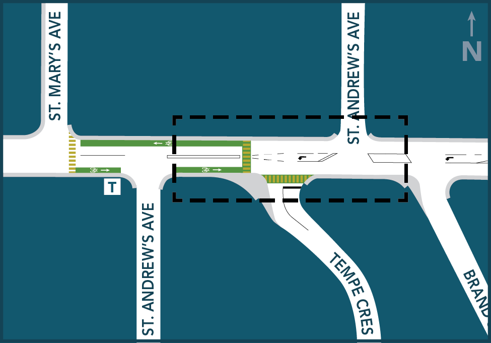
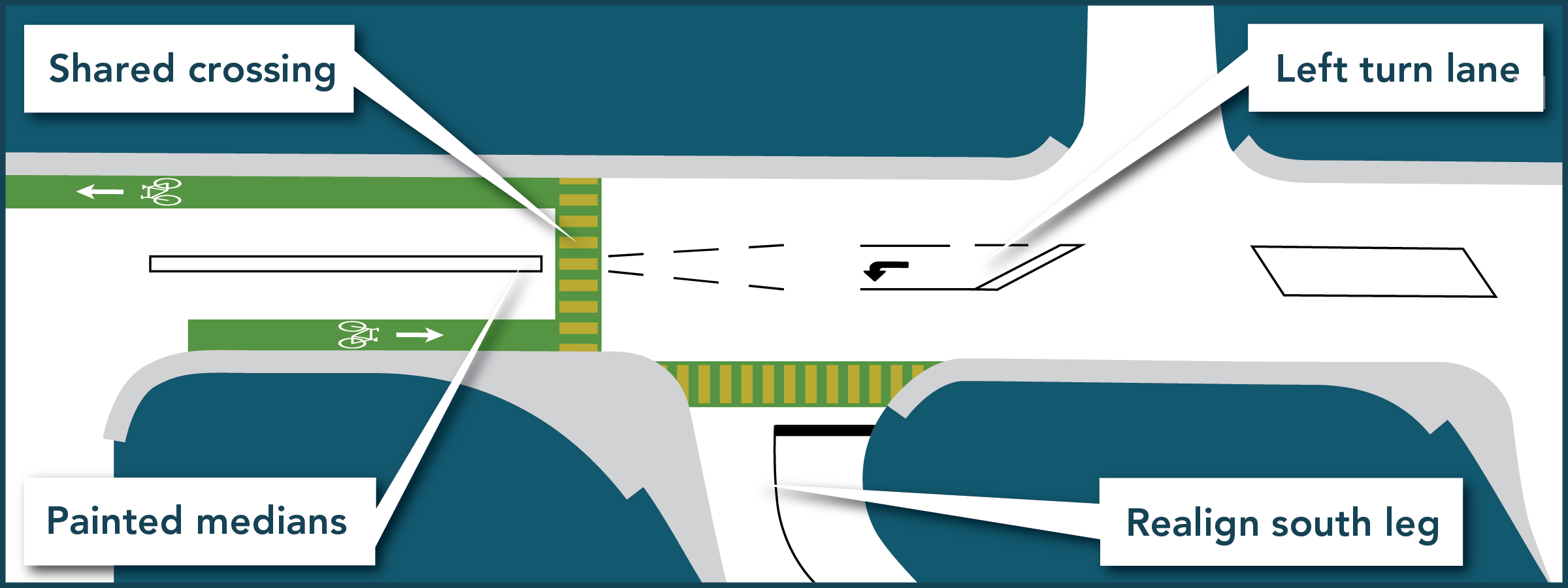
- Protected, two-way cycle track — Tempe Crescent to Royal Avenue on the south side of East 29th Street
- Pedestrian crossing with flashing beacons — at Royal Avenue, to assist cyclists to safely access the new two-way cycle path and bike route on Tempe Crescent
- Buffered bike lanes — east of Royal Avenue to Lynn Valley Road in both eastbound and westbound directions
- Westbound cycle track — protected by on-street parking between Fromme Road and Lynn Valley Road
Drivers
- New left turn bays — St. Georges Avenue, St. Andrews Avenue, Brand Street (west), Somerset Street, Regent Avenue, Tempe Crescent, and William Avenue to improve vehicle safety and mobility
- Full traffic signal — at William Avenue, to improve safety, reduce vehicle delay, and increase capacity and efficiency through the intersection
- On-street parking maintained — between Fromme Road and Lynn Valley Road on the north side and between Lonsdale Avenue and St. Mary’s Avenue
Transit users
- New crosswalks — positioned closely to bus stops along East 29th Street
- Completed sidewalk sections — for safety walking to and from bus stops
Interested to learn more about our community consultation process for this project? View the project background section below.
How work will impact traffic
Information about major traffic changes will be updated on large signs within the construction zone when project work is anticipated to impact traffic. To facilitate the safety and mobility improvements, including the introduction of left turn lanes, street parking between St. Marys Avenue and Fromme Road will be permanently removed.
Project timeline
Work will begin summer 2019 with an anticipated completion date of fall 2019.
Drawings, photos
Renderings of the mobility and safety improvements along the East 29th Street corridor.
Progress updates
February 4, 2020 — New traffic light
A new traffic light and signal has been installed at East 29th and William Ave, replacing the four-way stop at the intersection.
November 18, 2019 — Construction updates
The following work has been completed:
- Paving from Regent Ave to William Ave
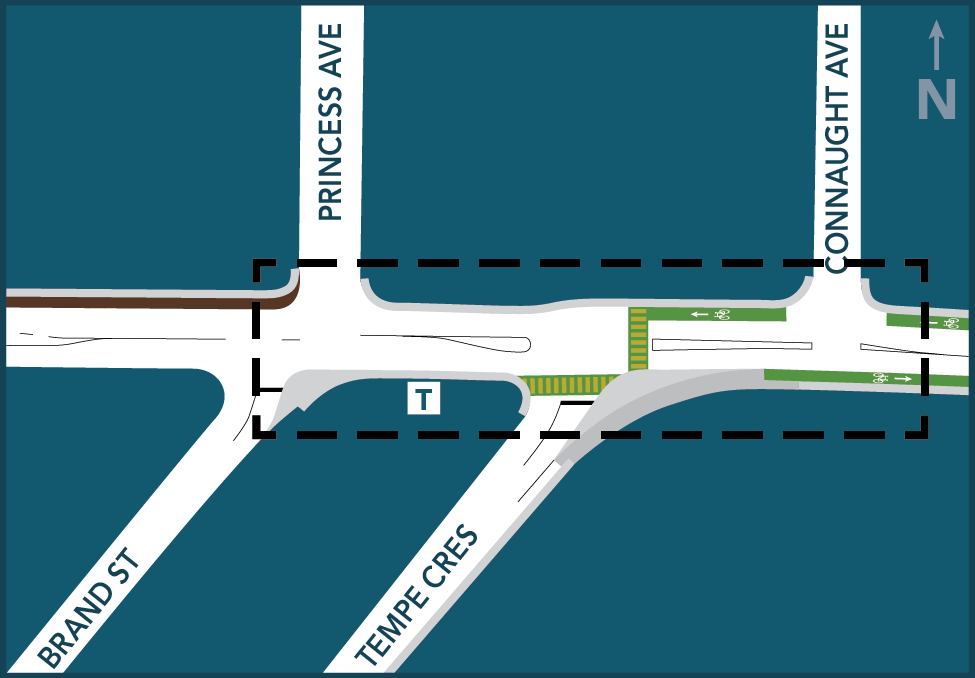
- New sidewalks at St. Kilda Ave to Regent Ave and Princess Ave to Connaught Ave
- Two-way protected cycle track from Tempe Cres to Tempe Glen Dr
October 14, 2019 — Construction updates
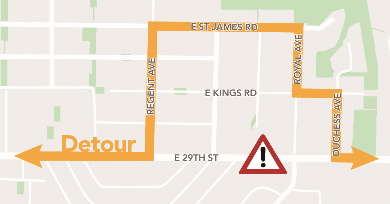
Weather permitting, we'll be paving East 29th Street between Regent Ave and Duchess Ave on Monday, October 14 starting at 12pm, working late into the evening hours until work is complete.
A full road closure and detour will be in effect.
Detour
August 30, 2019 — Construction updates
Both new sections of sidewalk at St. Kilda Ave to Regent Ave and Princess Ave to Connaught Ave are now complete, along with the concrete median for the two-way cycle track.
Two new flashing crosswalks located at Royal Ave and Regent Ave are also under construction.
July 22, 2019 — Council meeting
Staff presented Council with an update on the project. Council directed staff to proceed with construction as planned.
They also directed staff to look into potential options that ease the impact of on-street parking loss, including allowing on-site parking variances, adding new drop-off zones in key locations, or opening up laneways.
Staff will examine options, discuss with residents who are directly affected, and report back to Council. Review and design will take some time and can be expected to occur in early 2020.
Download the staff presentation
July 22, 2019 — Public open house
We hosted an open house for the public to share outstanding safety concerns regarding the planned improvements on East 29th Street with staff.
Phase of work
Phase 1: Public consultation on safety concerns (October 2016)
To gather information about what the potential safety concerns are along E.29th Street, we surveyed the public. We received 394 responses to our online survey. Here is a summary of what we heard.
EXPLORE | Hover over or select the graph to view details, and to scroll through all of the graphs
Phase 2: Issues identified through consultation and technical survey (2017)
Following our public consultation in October 2016, we completed a technical review in September 2017. Here are the major themes and specific challenges that were identified during both the consultation and review.
General themes emerging from the consultation and study
Walking
- Limited marked crosswalks, uncomfortable to cross at some locations (especially the hill)
- Some gaps in the sidewalk network
- Skewed and wide side street intersections at six locations
Cycling
- No dedicated on-street bike accommodation (narrow, shared lanes only)
- Minimal bike route signage
- Uncomfortable for people to bike to and from the Tempe Crescent cycling route (crossing E. 29th Street) to bypass the hill
Driving
The posted speed limit is 50km/h, however 85% of westbound vehicles were measured at:
- 57 km/h at St. Andrews Avenue
- 66km/h at Tempe Crescent
- 72 km/h at St. Georges Avenue
Driveways
- Sight line issues (hedges, parked cars)
- Reverse-out conflicts
- Inconsistent driveway drop design (pedestrian risk)
Street name signs
- Placement
- Inconsistent size
- Inconsistent design
Parking
- Parking near Lonsdale Road and Lynn Valley Road is well used
- Parking in the central section of the corridor is generally underused
Specific areas along the E. 29th Street corridor with challenges
Using both the feedback from residents, and the technical study of the corridor, we have identified the areas of E. 29th Street with the most significant challenges.
EXPLORE | Hover over or select the pins on this map to get additional information about each location.
Phase 3: Potential tactics for solving identified issues (2017)
After reviewing the feedback we received from the public during our consultation in 2016, along with our technical review, we identified a number of traffic management tools and solutions that we could potentially use to resolve some of the issues.
Explore the possible solutions
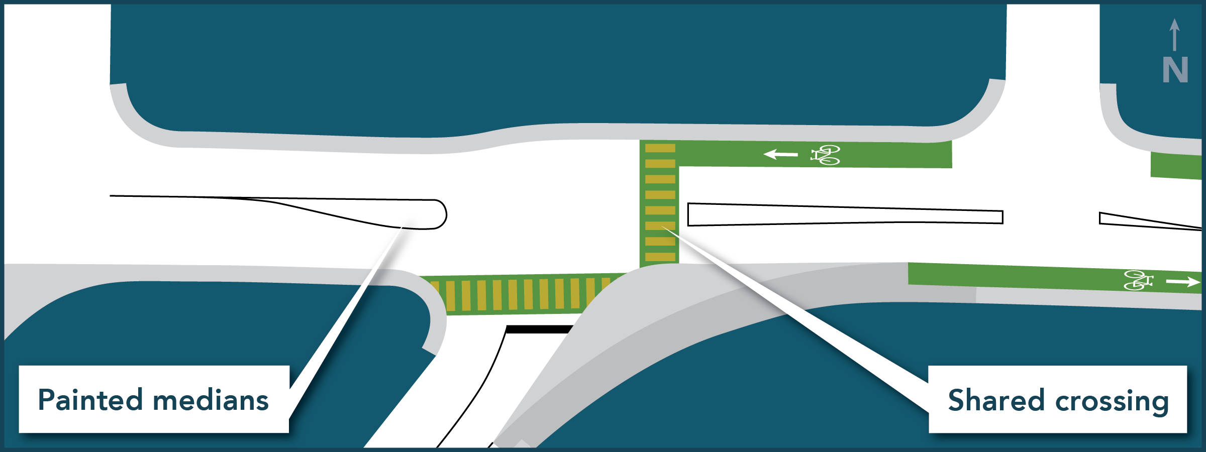
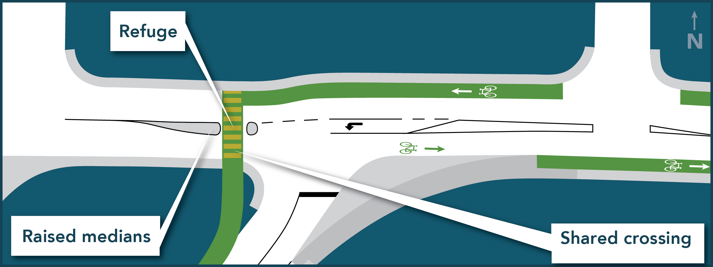
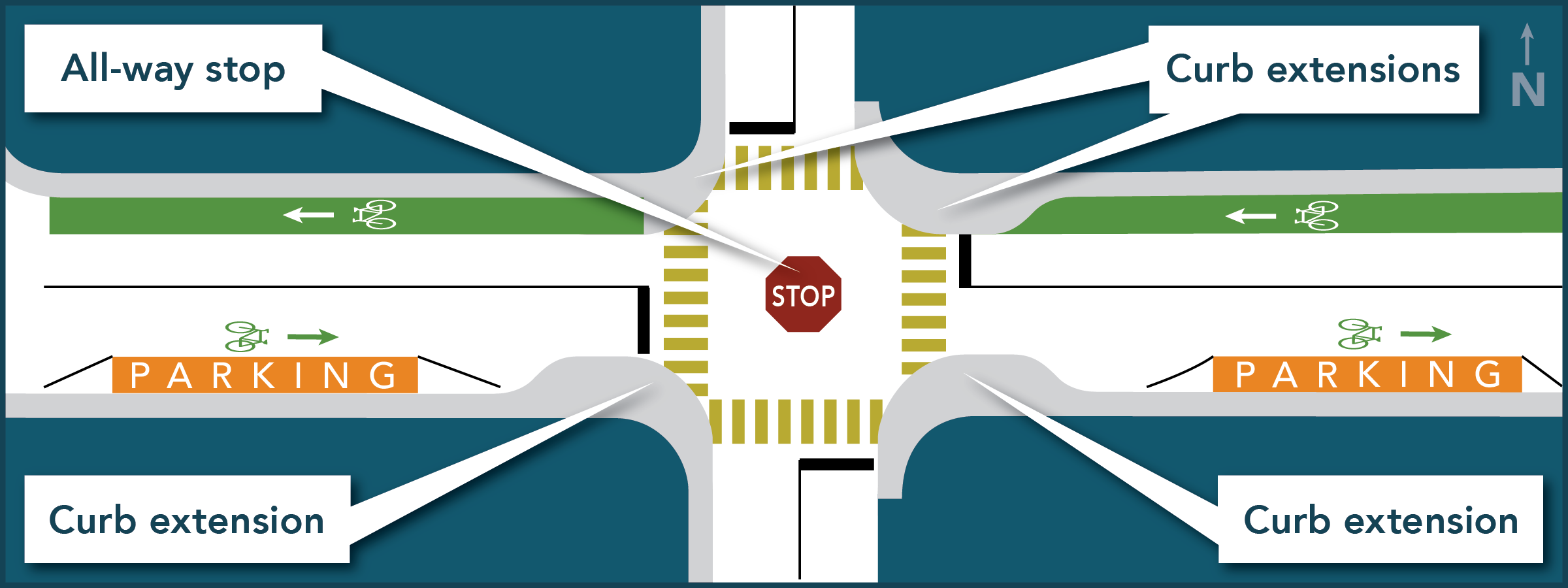
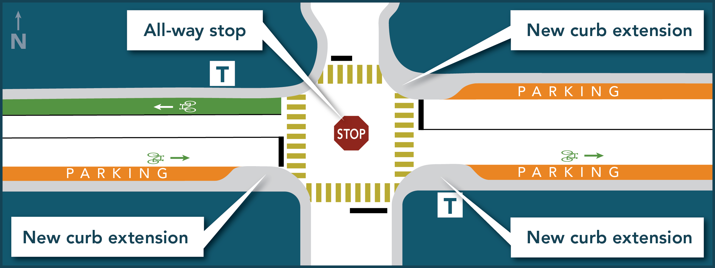
Here are some of the potential traffic management tools and solutions we considered for East 29th.
EXPLORE: Select an image to view a larger version, or to scroll through all images
Other tools that will help guide our decisions around E. 29th Street
While we will rely on the input we received through the survey and technical study, there are other, larger strategies and policies that will help guide our decisions around how to address issues along E. 29th Street.
Official Community Plan
The Official Community Plan sets the direction for future growth and change in the District through 2030, as guided by the community's vision.
As a broad policy framework, the OCP guides planning and decision making about the future of our community, and works together with more detailed strategic action and implementation plans, such as the Corporate and Financial Plans, our Centres Implementation Plans, the Transportation Plan, the Parks and Open Space Strategic Plan, and others.
Transportation Plan
Our Transportation Plan is designed to make the District an even better place to live, by providing many options for walking, cycling, transit, and safe driving.
The plan addresses our Official Community Plan goals of reducing greenhouse gas emissions, improving public health, taking advantage of partner funding for improving infrastructure, and developing more options for how people of all ages and abilities get around in our community.
Learn more about the Transportation Plan
Phase 4: Public consultation on proposed solutions (March 2018)
Between March 6 and 30, 2018, we presented a number of solutions to the issues identified during previous phases of this project, and asked residents to share their views. We received 530 responses. View a summary of the feedback we received
Explore the proposed solutions
Here are some of the potential solutions we have proposed for East 29th.
EXPLORE: Select an image to view a larger version, or to scroll through all images


Parking pocket updates
September, 2023 — Work complete
The work to implement parking pockets on East 29th Street between Williams Avenue and Fromme Road is now complete.

June 19, 2023 — Project update to Council
Council met to discuss parking solutions for a portion of East 29th Street between William Avenue and Fromme Road. At the meeting, Council directed staff to deliver "parking pocket" solutions on the south side of East 29th Street that retain the existing cycling and sidewalk facilities and to address accessibility needs of adjacent residents.
View the agenda item and reports
February 6, 2023 — Council workshop
At the Council workshop, staff presented possible parking pocket solutions for East 29th Street, similar to what was recently constructed, and lessons learned, as part of the Lynn Valley Road Active Transportation project. Staff were directed to bring this topic back to a Regular Council session for consideration so that the decision could be formally adopted to enable implementation.
View the agenda item and report
January 9, 2023 — Council motion entitled East 29th Street delineators
A council motion was brought forward at this Regular Council meeting that recommended removal of the bike lane on the southern side of East 29th Street, between William Avenue and Fromme Road, in order to reinstate on-street parking. This motion was referred to a Council workshop.